blah blah blah
Bacon Ledge
Length: 3.2 miles out-and-backDifficulty (click for info): Easy
Elevation Gain: 680 feet (+10 feet on return)
Rating (click for info): 4/10
Elevation: 1964'
Prominence: 667'
Driving Directions:
Trailhead and parking area are on Old Antrim Road in Stoddard, NH. To get there, follow Rt. 123 to Mill Village, 1.8 miles north of Rt. 9. Turn east onto Shedd Hill Road and quickly turn right onto the unmarked Old Antrim Road. Use caution, as this road is very narrow. In 0.5 miles, after passing all the houses, there is a good pull off on the right just before the road climbs a hill with several protruding rocks. Look for two small boundary markers with the Forest Society logo. You will need to walk the last 0.4 miles on the road to reach the trailhead, as mentioned above. Even if you have a high-clearance vehicle, don't try to drive to the trailhead, since the road sidehills a very steep slope and there is no room at all to park. Click here for a Google map.
About the Hike:
The Peirce Reservation is one of the Forest Society's largest properties. The property encompasses several ponds and hills, including the summit of Bacon Ledge. The well-maintained and pleasant Trout-n-Bacon Trail climbs to Bacon Ledge, which has nice views over the trees, but strangely, the Forest Society does not promote the property as one of its "Featured Reservations". The trail does not have a Forest Society sign and kiosk or even a parking area. Due to its obscurity, you will most likely find complete solitude on the trail. Don't let its unpopularity deter you from visiting this fine destination.
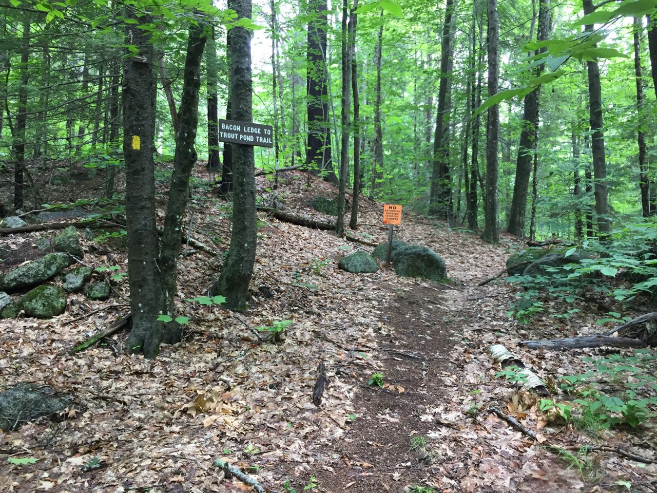
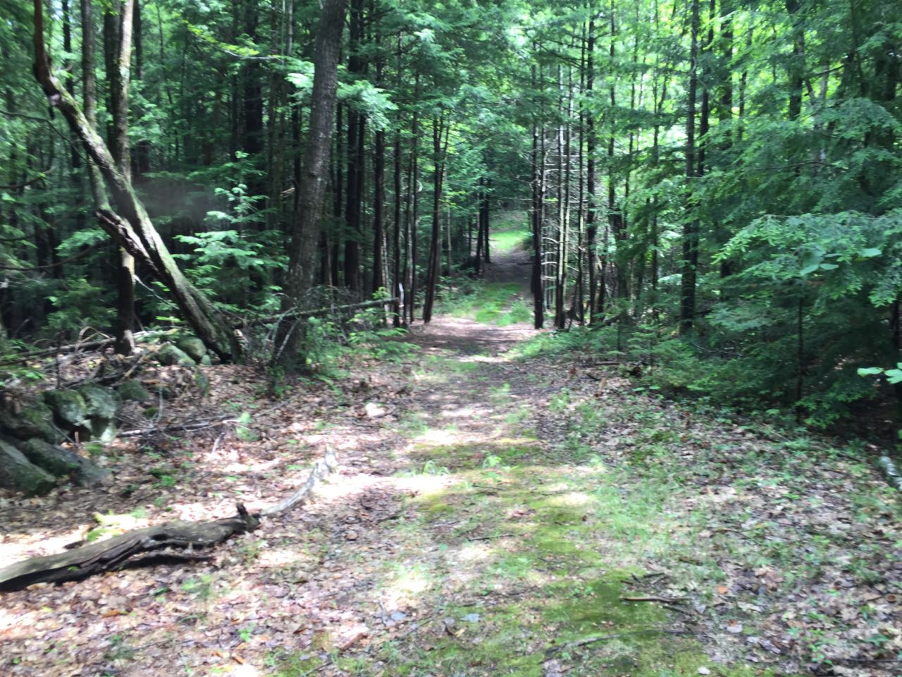
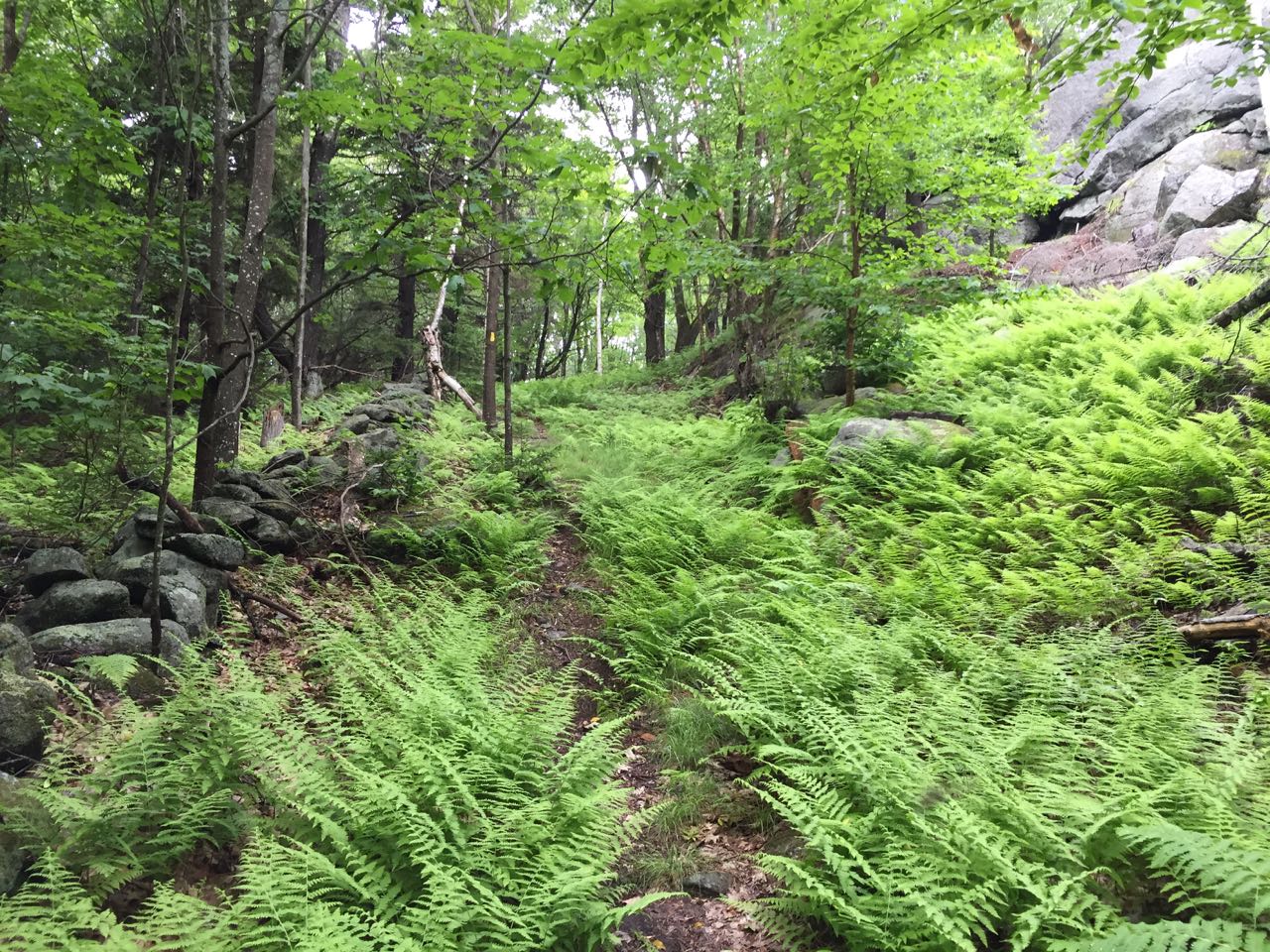
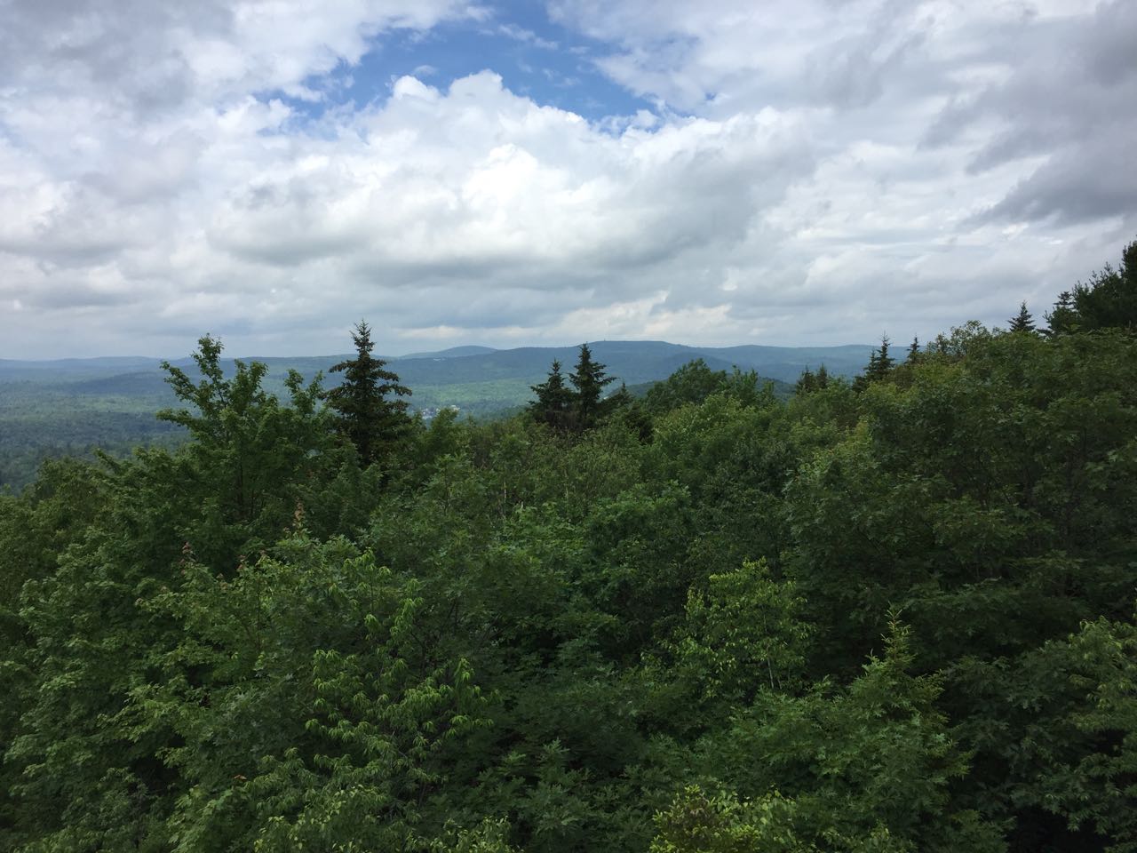
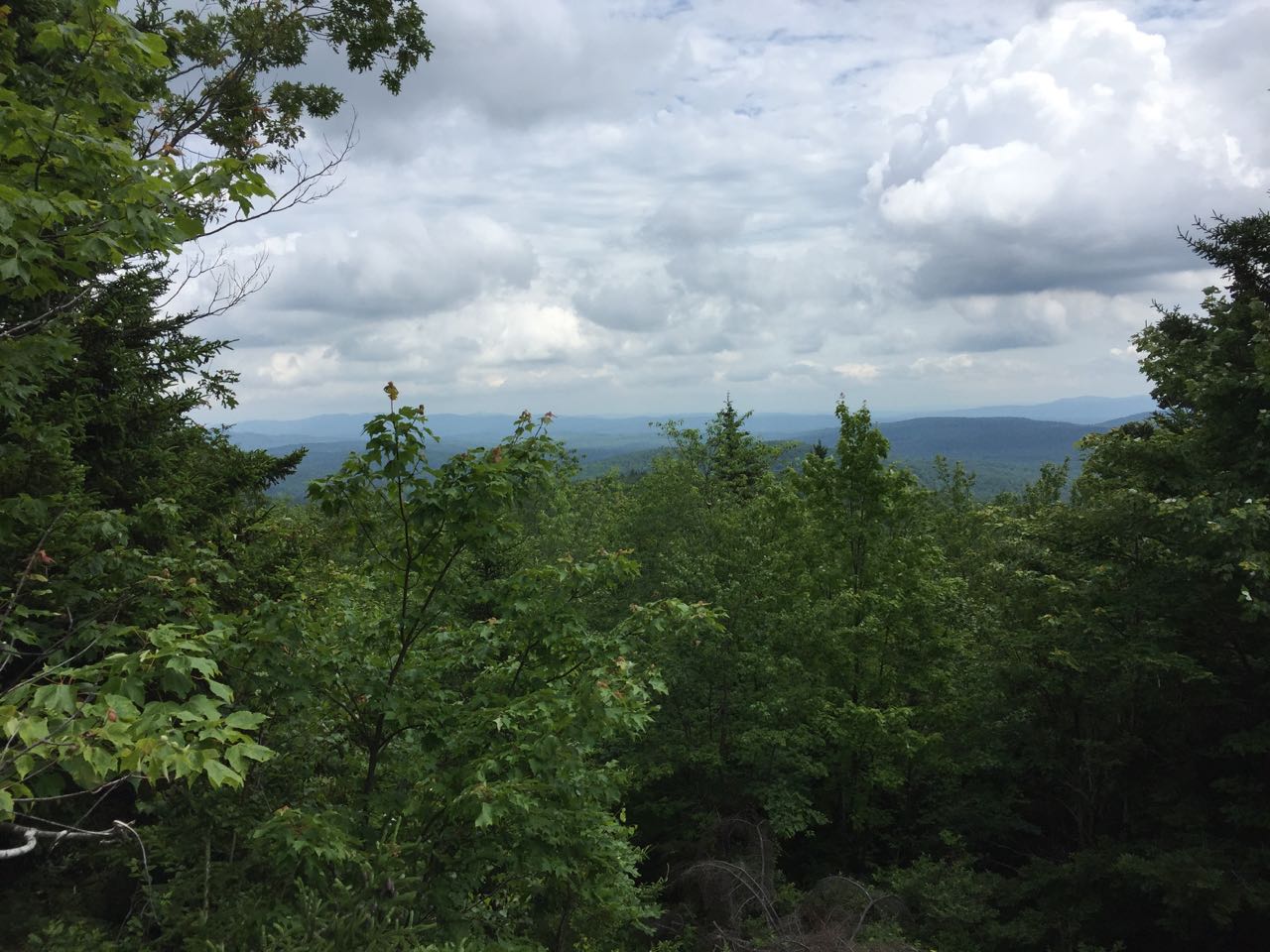
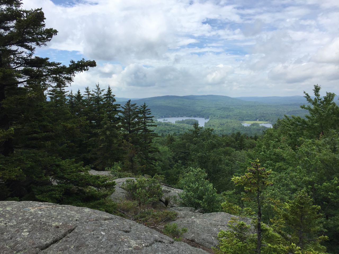
The Trout-n-Bacon Trail begins on the left side of Old Antrim Road at a clear sign, just past a gated woods road. Due to the condition of the road, you will have to walk 0.4 miles to reach this point. The trail heads out to a woods road and turns right onto it. The trail follows the woods road on a mostly flat course for a while, then it begins to climb gradually. Many sections along the woods road are prone to mud. After 0.7 miles, bear right as the road swings to the left along with a ski trail. Don't be fooled by a stray blaze on the left fork; the right fork is the trail and the turn is blazed as such. The path heads slowly up and across the hill into an open forest and begins to switchback. It ascends easily for the last half mile. Just before reaching the top, the trail passes beside the cliff below the outlook and leads past to ascend from the side, where there is a minor rock scramble. The trail emerges on the open summit of Bacon Ledge, where you immediately see a fine view over the trees to the southwest. Part of Highland Lake is in view under a long ridge of small hills. The fire tower on Pitcher Mountain appears to the right. The trail continues over the summit and eventually on to Round Mountain. For another small viewpoint, walk just past the large cairn and down to a cleared area with a minor view to the northeast.
Printable directions page